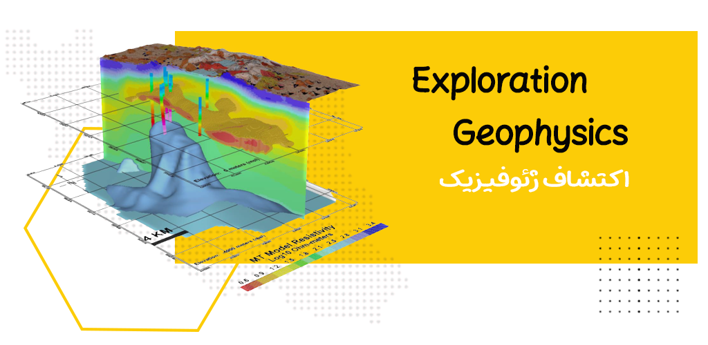
After that, the increasing market demand for metals and the unprecedented increase in the use of oil, gas and their derivatives at the beginning of the 20th century led to the development of many geophysical methods. And in the field of invention and development of geophysical devices, many advances have been made since the Second World War. Since the beginning of the 1960s, with the widespread use of computers in the processing and interpretation of geophysical data, there has been a huge evolution in this branch of knowledge. Since most of the mineral deposits buried under the surface of the earth are covered by an overburden, the discovery of these deposits depends on the properties that distinguish them from the surrounding environment. If there is a difference in the physical properties of this mineral and its embedded stone; Surface geophysics can be used to discover the relevant mineral.
According to the type of physical properties, different geophysical methods are created, and the following methods are based on this.
· Seismic methods are based on the elastic properties of rocks in the studied environment.
Electrical methods are studied depending on the electrical properties of the earth.
· Gravimetry methods are related to the density characteristics of rocks.
· Magnetometric methods are related to the magnetization properties of rocks
. Radiometric methods are related to the radioactive properties of rocks.
With the use of these methods, information is obtained from buried geological structures that can be used directly or indirectly in the exploration of minerals, hydrocarbons, underground water, engineering, environmental, archeology, etc. Today, geophysical measurements have been used and have a very wide scope, to the extent that these studies are currently also carried out on the moon and ice spheres. Applied geophysics, which is mainly used in the exploration of minerals, hydrocarbons and groundwater studies, is divided into the following methods:
– Gravimetric methods
– Magnetometric methods
– Seismography methods
– Electrical methods
– Electromagnetic methods
– Radiometric methods
– Well drilling methods
– Thermal physical methods and…
Geophysics is mainly an indication of geological features of buried structures along with mineral reserves of oil, gas, etc.
Choosing the type of geophysical method or methods is one in practice in order to locate a certain mineral reserve depending on the nature (physical properties) of the corresponding mineral and directly indicating the presence of the studied mineral. Such as the magnetometric method that is used for the exploration of iron or nickel minerals. At other times, the geophysical method may indicate whether the conditions are favorable for the formation of a desirable mineral or not.
For example, the use of magnetometric method in oil exploration as a tool to determine the thickness of sediments up to the bedrock and to determine whether the sediments are thick enough to have significant hydrocarbon storage capacity. From another point of view, geophysical investigations are carried out in four ways: ground, air, sea and well.
Aerial impressions:
The methods of magnetism, electromagnetism, radiometry and recently airborne gravimetry are the fastest methods of exploratory geophysics. Especially, these methods are less expensive than ground methods to cover large areas and are mainly used in the mineral exploration phase. In this practical method of harvest with
Installation of appropriate equipment is done inside or behind the aircraft and helicopter.
More detailed exploration of the promising areas identified by airborne methods is followed by ground geophysical methods.
Marine impressions:
The harvesting environment in this section is the water environment. The purpose is to identify the physical characteristics of the ground under the water bed. The equipment needed in this section has little structural differences with other sections; But the theory of all these methods is approximately the same. These equipments can be installed inside the ships or behind them. The main applicable methods in this environment are seismography, gravimetry, magnetometry, electromagnetism, etc.
The results of the well survey:
In these surveys, the geophysical equipment is sent into the borehole in a cylindrical chamber called a probe with a smaller diameter than the borehole, by a string of cables connected to the wellhead measuring device (ground level).
One of the goals of these surveys is to continuously record the physical characteristics of the formations inside the borehole. Applicable methods in this section include sound methods, radiometers (neutron rays, gamma rays, gamma rays, etc.), resistance measurement, induction electromagnetism, etc.
Ground impressions:
These harvests are done on the surface of the earth by special devices. One of the most diverse geophysical perceptions is made in this department and is more developed than other departments. The types of terrestrial geophysics methods are:
as follows:
Gravimetric method:
In this method, changes in the earth’s gravity field are measured at different points. According to the relationship between the gravity and the density of different subsurface masses, by recording the gravity field, it is possible to discover minerals with higher or lower density than the surrounding rocks. This method can be used on the surface of the earth or inside underground tunnels. performed In hydrocarbon discoveries, this method is used together with magnetometry as an identification tool. The implementation of this method is cheaper than seismic methods and more expensive than other geophysical methods.
It is especially useful in engineering and archeology studies, especially for discovering underground cavities. In gravimetric method, like magnetometric, radiometric and some electrical methods, the field measurement is done with an underground natural spring. For the first time Around 1589, Galileo discovered the effect of the acceleration of the earth’s gravity on objects of different weights. After him, Kepler proved the laws of planetary motion, and after him, Newton reported the general laws of gravitation in 1685.
During the years 1735-45, Pierboger obtained many basic relationships of gravimetry, including changes in the acceleration of gravity with altitude, latitude, etc. The first gravitational field measuring device (compound pendulum) was invented in 1817 by Captain Henry Keeter.
Magnetometry method:
The magnetometric method, which is the oldest method of geophysics, is an exploration; In principles and even interpretation, it has many similarities with gravimetric methods. But normally, this method is more complicated and the changes of the magnetic field are more irregular and local than the acceleration of the earth’s gravity. In this method, the changes of the earth’s magnetic field are measured. Because some materials such as magnetite show high magnetic anomalies in the Earth’s magnetic field. Iron deposits, copper skarn, nickel and asbestos can be easily explored with magnetometric surveys due to the association with magnetic ores. Even some exploratory geophysicists recommend this method for the discovery of placer gold due to its association with black sands containing high amounts of magnetite.
Seismography method
Seismography methods are based on the fact that elastic waves travel at different speeds in different layers below the surface. Therefore, in these methods, the waves are generated at one point and at a series of other points, the arrival time of the reflected or refracted energy from the discontinuities or the interface of disturbed layers is measured. Using seismic method, the position and structure of subsurface layers is determined. The most important advantage of seismic methods compared to other geophysical methods is that with the proper application of this method, a more accurate and clear interpretation of the subsurface structure is obtained.
Most of the seismic theories were identified before the construction of measuring devices. Before the discoveries of earthquakes, the science of seismology, which in theory has many similarities with the method of seismography; was developed In 1845, Mallett tested the measurement of the speed of seismic waves in different layers of the earth by creating artificial earthquakes.
The main application of seismic methods in oil exploration is that these methods are widely used in this sector. Seismography methods are widely used in the identification of large-scale geological structures for the purpose of structural investigations and important engineering projects, such as determining the depth of bedrock, identifying sand and sand deposits, identifying fractured watery areas, etc.
Radiometric methods:
Radioactive elements in rocks cause various alpha, beta, gamma and ka-kap radiations. The intensity and weakness of these radiations vary depending on the type of radioactive element and its amount in the rocks. If we can record this intensity and weakness and type of radiation; The goal is to identify the radioactive element and its amount in the formation. In radiometric discoveries, only gamma ray recording is important; Because alpha and beta radiations cannot be detected only with a thin covering of soil, water or air. Of course, gamma rays also penetrate only a few inches into the rock and soil and up to several hundred feet in the air and can be recorded. As a result, only radioactive deposits can be discovered with this method that have not occurred; Or they are located in very shallow depths of the earth.
.
The main radiometric methods are airborne geophysical methods, and ground methods have not developed much. Because for every hundred meters of height, the intensity of gamma rays emitted from minerals drops by only 50%, and in this regard, airborne methods are very It is more economical than ground methods. Radiometric methods are less important compared to other geophysics methods.
It should be noted that the above-mentioned factors never affected the radiometric methods of drilling wells; Because these methods were commonly used since their invention. Geiger counters and centimeters, which are the measuring tools of this method; They are easily portable and can be transported by person, car or plane.
Electrical methods:
These methods, which are considered among the most diverse exploratory geophysical methods, provide very useful information about the lateral or depth distribution of electrical properties of subsurface materials; that this information can be used directly or indirectly for the purpose of mineral exploration or other purposes. The source or source of energy in electrical methods can be natural or artificial.
A) Electric methods with natural spring, some of the most important methods are:
Spontaneous potential method:
The spontaneous potential method, as its name suggests, is based on the measurement of the natural potential difference that exists inside the earth. Part of this potential difference is fixed and part is variable (induced ion polarization).
In practice, the recorded potential difference is related to the fixed part, which is formed due to electrochemical reactions with different mechanisms. The value of spontaneous potential recorded on the surface of the earth varies from less than one millivolt to hundreds of millivolts. High potential values It can be measured spontaneously on the masses of sulphide, graphite, magnetite, and several other conductive minerals such as coal and manganese.
Tellur method one:
Tellurian currents are the currents that exist under the surface of the earth. The source of this current is outside the earth. Periodic and sudden changes are related to the daily changes of the earth’s magnetic field and their cause is solar radiation, aurora borealis, etc.
These activities have a direct effect on the ionospheric currents and it is believed that the tellurian currents in the earth are induced by the ionospheric currents. And
With the measurements of Tellur one, it is possible to identify salt domes, anticlines and depressions, which have high specific resistance rock at their base. Because the above-mentioned stone causes the deviation of the telluric currents in the axis of the mentioned structures. This method is also used to identify bedrock irregularities.
Magnetotelluric method:
The magnetotelluric method includes the comparison between the amplitudes and phases of the electric and magnetic fields associated with the telluric currents. In Tellur’s method, one goal is to measure the electric and magnetic fields caused by these currents. Measuring the electric field (telluric method) is relatively easy. But measuring the magnetic field is more difficult and complicated because we are dealing with frequencies less than 0.001 Hz up to 10 kHz. Due to the weakness of the natural energy source inside the earth, the signals measured in this method are weak. And it is mainly affected by jamming.
However, the depth of search in this method is greater than other electric methods and even reaches several kilometers. This method was identified and expanded following the development of electromagnetic theories and the Tellurian method
This method is used in the exploration of hydrocarbon reserves, massive sulfides, base and precious metals, and geothermal energy sources. In addition, it is also used in structural geology, environmental petrology and geotechnics surveys.
b) Electric methods with artificial springs
Some of the most important of these methods are:
Resistance measurement method:
This method, which is wrongly called geoelectric method in our country, is one of the oldest electrical methods.
In resistivity method, the aim is to record the potential difference caused by sending direct or alternating current with a very low frequency into the ground. Different electrode arrangements are used to record this potential difference. The measurements made using simple mathematical relationships are converted into the resistance and electrical characteristics of the stones, and finally the obtained information is interpreted.
This method is mainly used for the exploration of mineral materials (especially metals), identification of underground water sources, engineering surveys to identify holes, faults, cracks, glaciers, underground tunnels, archeology especially to identify old buildings and buried buildings. And … is used.
Inductive polarization method:
Similar to the resistivity method, in this method artificial current is sent into the ground with the same arrangements as the resistivity method, and the potential difference is measured after the current sent into the ground is cut off. Measurements can be recorded in both frequency and time domains.
The special applications of this method are in the exploration of alluvial metals such as peripheral copper, lead and zinc, graphite, shale and clay resources, oil discoveries, geothermal resources, underground water investigation and environmental studies.
It is environmental.
Mass connection method: In this method, a current electrode is connected to the exposed conductive ore mass, and the other current electrode is placed at a distance from the first electrode; Then the electrical potential is measured at several points on the ground surface inside the boreholes after removing the self-generated potential.
The special application of this method is in detecting the size and volume of conductive mineralization masses with outcrops. In other words, using this method, it is possible to find that firstly, how many subsurface masses are there; Secondly, the presence or absence of mineralization in the depths of the earth can also be detected.
Specific resistance magnetometry method:
In this method, direct electric current is injected into the ground through two electrodes with relatively large distances from each other.
Then, the subsurface anomalous conductivity in the middle of the two current transmitting electrodes is measured with the help of the secondary magnetic field caused by the current passing into the ground, by a very sensitive magnetometer with low interference that is placed perpendicular to the line between the two electrodes. The theory of this method was recognized by Jakowski in 1933, but practically since 1974 by
Edward was employed. This method is used to identify subsurface conductor masses and identify conductor faults.
Magnetic induction ion polarization method:
This method has a lot of similarities with the special resistance magnetometry method; The similarity of these two methods to each other is the same as the similarity of the induction polarization method to the resistivity method. This method can also be measured in two realms of time and frequency.
In this method, two quantities are recorded. One of the components of the magnetic field caused by the passage of direct current is also used. In the frequency domain, first the initial magnetic field is normalized and then the magnetometric value of specific resistance is measured. But in the domain of time, the average charge at certain time intervals is normalized by dividing by the initial magnetic field, then recorded.
The special application of this method is in the identification of subsurface conductive deposits, especially metal deposits and peripheral deposits.
Nuclear magnetic resonance method:
The basis of this method is the physical phenomenon of nuclear magnetic resonance; which developed the method of light spectroscopy with microwave (approximately one thousand to one hundred thousand megahertz) and radio (approximately ten kilohertz to one hundred megahertz) frequencies.
In these frequency ranges, light is absorbed and propagated by the same processes in other wavelengths of the electromagnetic spectrum. The main philosophy of this method is based on the fact that the nucleus of many atoms, including water protons, has a non-zero dipole moment due to the presence of rotating charged particles.
The main application of this method is to check the quality and exploration of underground water sources.
Electromagnetic methods:
Today, electromagnetic methods are the most widely used among geophysical methods, except for the magnetic method, in the exploration of mineral materials. These methods are not suitable for oil exploration because the best answer in these methods is related to the conductive masses located at shallow depths of the subsurface. These methods have not been used much in engineering activities.
However, they are sometimes used to identify buried pipes and cables, to detect mines, and to investigate pollution located at shallow depths.
As the name of these methods suggests, these methods include the propagation of continuous or transient wave electromagnetic fields above the surface of the earth or in its depths. In these methods, the transmitter, receiver and the buried conductor mass are in a three-way confrontation with the electromagnetic field, and the electric currents inside the conductor mass are
Along with electromagnetic induction, they occur simultaneously. Generally, in these methods, the energy source is created through induction inside the ground; However, in several cases of electromagnetic ground methods, this source is in direct contact with the ground.
Methods such as magnet and telluric, whose source of energy is natural, are sometimes mentioned other than electromagnetic methods. The receiver also receives the response by induction.
Ground penetrating radar method:
This method, which most of the experts consider as one of the electromagnetic methods; It is the emission of electromagnetic waves with high pressure for the purpose of subsurface investigations.
Radar is a system using short period electromagnetic pulses that was first used by the British Ministry of Defense to identify enemy aircraft during World War II. Guinke, several similar systems existed before this war in France, Germany, the United States and even England.
Apart from various military and engineering applications, today radar is a very important tool in subsurface investigations. Due to the high frequency used in this method, the depth of penetration in the ground is very low, so it is not used in the exploration of mineral materials except for materials close to the surface. But in many activities
Engineering, especially geotechnical, soil investigation, geological investigations, hole identification, archeological investigations, investigations of shallow underground water resources and subsurface pollution have wide applications.
We have formed a company in the field of design, manufacture and production of advanced electronic equipment and tools so that we can take a step in meeting the technological needs of the country by relying on modern science and experience.
All rights reserved by fannavarane madarpardaze arta novin